Situational awareness faster and easier
A geospatial analytics platform that converts flight footage into 3D models and orthophotos, in
GNSS-denied environment.
About FSV Platform
Building Digital Twin faster
Simply upload media from your drone and click to render.
Our algorithms will handle the rest.
Intuitive map binding
The easy location search and placing of ground control points help bind an orthophoto from a
GNSS-denied environment to a map.

Detection and inspection
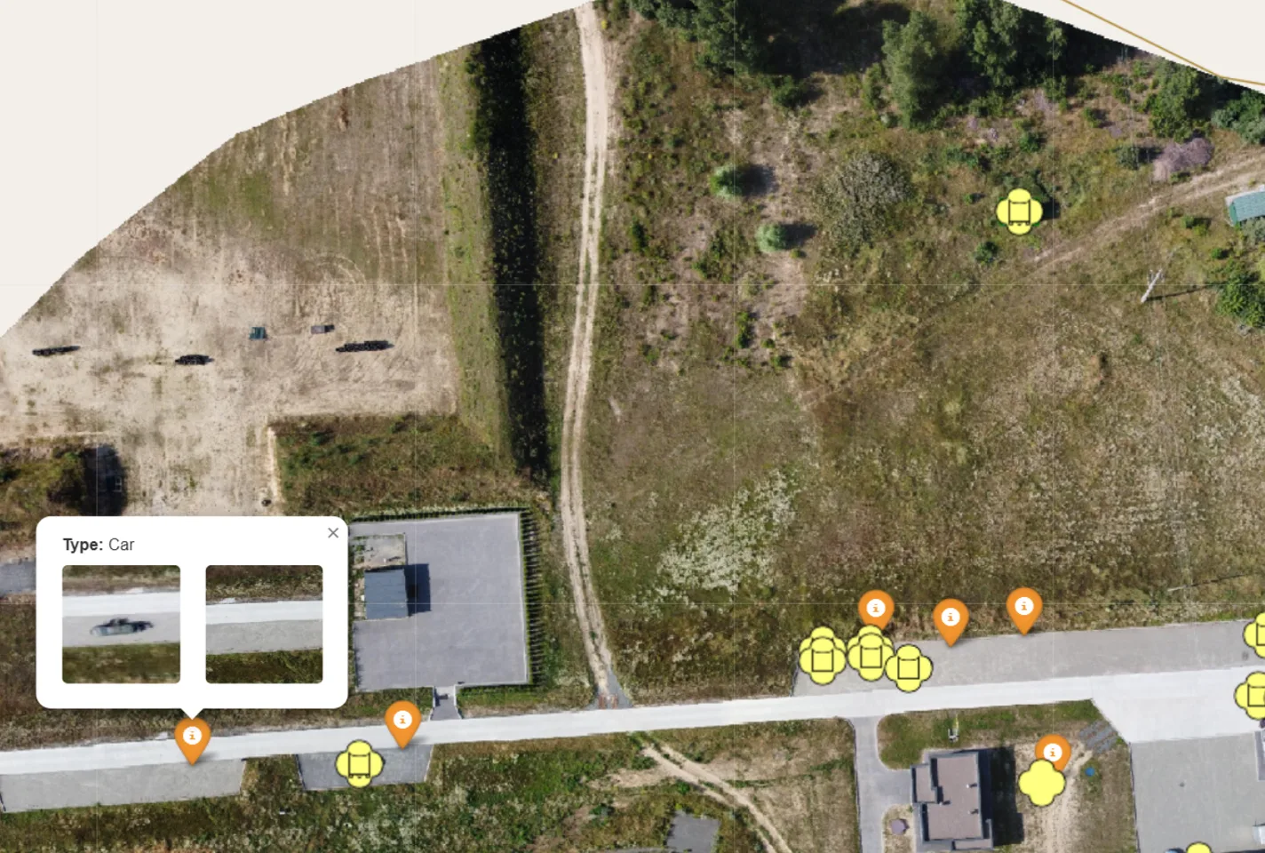
Our computer vision algorithms autonomously detect objects of interest and highlight critical
environmental changes.

Comprehensive 3D Model
When working with the 3D model of an orthophoto, users can measure distances, areas, heights, and
other parameters.

Virtual Reality streaming
VR capabilities for training, terrain analysis and mission planning.
Industries
Streamlining performance
Drive industry innovation with Farsight Vision solutions.
Agriculture
Maximize crop yields and resource use.
Construction & Architecture
Streamline design precision, enhance project execution, and improve safety.
Search & Rescue
Increase effectiveness and speed of operations.
Infrastructure
Streamline monitoring and inspection of remote locations, preparation for maintenance.
Insurance
Improve risk assessment and claim processing speed.
Real Estate
Boost property value and investment returns.
Defense and Security
Streamline geospatial analytics and improve real-time intelligence.
Extreme Activities
Enhance visitor experiences and planning efficiency.
Recommended drones
Farsight Vision is a drone-agnostic platform
Currently, we have tested and recommend the following UAV systems for creating high-quality
orthophoto maps and 3D models.


Pricing
Choose the best plan for you
You can subscribe online now.
- 14-day free trial
- Processing handled in a general queue
- Up to 2 processes run simultaneously
- Data storage of up to 400 GB
- Maximum 10 GB per project
- 1 user included
- Free Android app
- Customer support included
Optional add-ons:
- Increased data storage
- Additional processing capacity
- Additional users
- Dedicated cloud server
- Server infrastructure is provided by the client
- License cost depends on the number of users
- Dedicated Account manager
- Customer support included
Request a demo
Experience the Power of Farsight Vision
Get a personalized demo to explore the full range of features and discover how our solution can
transform your workflow.
FAQ
Frequently asked questions
The Farsight Vision Platform processes photos, videos, and streams captured by UAV systems.
Supported image formats are jpg, png and tif. Supported video formats – mp4, avi.
Yes, we provide each user with a 14-day free trial.
Yes, our clients’ data is secure.
A Zero Trust approach is implemented — all connections and access requests are continuously
verified, regardless of their origin.
All communication between components is encrypted using SSL certificates.
User authentication and identification can be done through one-time codes sent via email or
services like Google or Delta, passkey or two-factor authentication (2FA) with the option for
users to choose the type of second factor.
Farsight Vision hosts the majority of its platform on the cloud, but the system can also be
deployed on users’ physical servers.
Yes, for the best quality of orthophotos and 3D models, we recommend UAV pilots to follow our
flight guidelines: ensure the minimum 75% image overlap, set the camera tilt to 90 degrees, and
record images with a resolution of 4000×4000 px.
Yes, we can work with media from any reconnaissance drone. In general, a drone camera should
have high resolution and good stabilization and a pilot should follow flight guidelines to
receive acceptable footage for generating orthophotos and 3D models.
You can upload and process your flight footage directly to the FSV Platform if you have a stable
and fast internet connection.
Data processing depends on the number of images and whether they contain GPS coordinates.
It depends on the type of drone and ground control you’re using. With a standard drone and
adherence to all flight recommendations, you can expect an orthophoto accuracy of 5–9 cm.
The maximum size for a single upload is up to 10 GB. If your file exceeds this limit, it is
recommended to split it into smaller parts before uploading.
Directly from the platform’s website, you can generate the necessary data for transferring
orthophotomaps to Kropyva, ComBat Vision, Delta, Neon and ATAK, as well as download the
orthophotomap in tiff format for further work with it in other software products.
